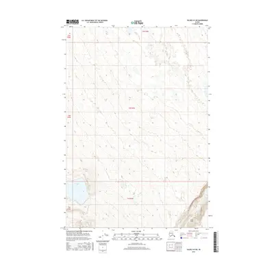
2016 Map of Valdez D-5 NE
USGS Topo · Published 2016About this map
Hudson Lake sits within a landscape defined by glacial topography and the complex hydrography of the Copper River basin. The southeastern corner of the quadrangle is anchored by a significant oxbow curve in the Klutina River known as Cooks Bend, where the river's path is constrained by steepening terrain. This 2016 survey documents the sparse infrastructure of the region, notably the Brenwick-Craig Road, which follows the river valley. The map illustrates the transition from the relatively level wetlands surrounding the lake to the more defined relief near the river, providing a precise record of the natural drainage patterns and land survey divisions, including parts of t1n r2w and t2n r2w, in this interior Alaskan wilderness.
Find a feature on this map
10 named features on this map. Tap any name to fly to it.
Don’t see what you’re looking for? This feature index may not catch every label — zoom into the map to look around manually.
Map Details
Editions of this 2016 Valdez D-5 NE Map
This is the sole edition of this map. No revisions or reprints were ever made.
Other maps of this area

1948 · Valdez D-5
USGS Topo · 1:63,360

1949 · Gulkana A-3
USGS Topo · 1:63,360

1949 · Valdez D-4
USGS Topo · 1:63,360

1951 · Valdez D-5
USGS Topo · 1:63,360

1951 · Gulkana
USGS Topo · 1:250,000

1951 · Gulkana A-4
USGS Topo · 1:63,360

1952 · Gulkana A-3
USGS Topo · 1:63,360

1952 · Valdez
USGS Topo · 1:250,000

1952 · Valdez D-4
USGS Topo · 1:63,360

1952 · Gulkana A-4
USGS Topo · 1:63,360