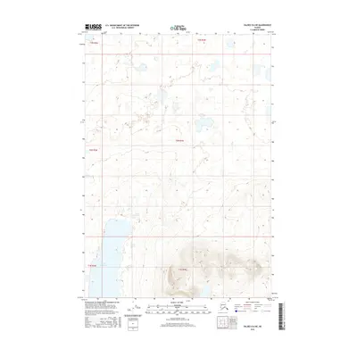
2016 Map of Valdez D-6 NE
USGS Topo · Published 2016About this map
Saint Anne Lake dominates the southwestern portion of this Alaskan landscape, providing a significant hydrological anchor in an area defined by complex township boundaries including t1n r5w and t2n r4w. The terrain is characterized by a dense network of wetlands and small unnamed water bodies that transition into higher elevations toward the southeast, where the waters of Nickel Cr emerge. This 2016 survey reflects a largely undeveloped wilderness within the Unorganized Borough, where the absence of roads or permanent structures highlights a preserved natural state. The detailed contour intervals and hydrographic data, sourced from the National Elevation Dataset and National Hydrography Dataset, offer a precise record of the drainage patterns and landforms as they existed in the early 21st century.
Find a feature on this map
8 named features on this map. Tap any name to fly to it.
Don’t see what you’re looking for? This feature index may not catch every label — zoom into the map to look around manually.
Map Details
Editions of this 2016 Valdez D-6 NE Map
This is the sole edition of this map. No revisions or reprints were ever made.
Other maps of this area

1948 · Valdez D-5
USGS Topo · 1:63,360

1949 · Gulkana A-5
USGS Topo · 1:63,360

1949 · Valdez D-6
USGS Topo · 1:63,360

1951 · Valdez D-5
USGS Topo · 1:63,360

1951 · Gulkana
USGS Topo · 1:250,000

1951 · Valdez D-6
USGS Topo · 1:63,360

1951 · Gulkana A-4
USGS Topo · 1:63,360

1952 · Valdez
USGS Topo · 1:250,000

1952 · Gulkana A-5
USGS Topo · 1:63,360

1952 · Gulkana A-4
USGS Topo · 1:63,360