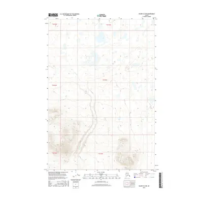
2016 Map of Valdez D-6 NW
USGS Topo · Published 2016About this map
Kaina Cr winds through the central and southern reaches of this Unorganized Borough landscape, carving a drainage path amidst a high-altitude plateau. The terrain is defined by a dense network of glacial lakes and wetlands in the northern sections, which gradually transition into more pronounced relief and ridgelines to the south. This Usgs topographical record highlights the remote hydrography of the region, where the Kaina Creek basin serves as a primary geographic anchor. The absence of road infrastructure or named settlements underscores the wilderness character of this area in the early twenty-first century, revealing a landscape shaped almost entirely by natural water cycles and glacial recession.
Find a feature on this map
7 named features on this map. Tap any name to fly to it.
Don’t see what you’re looking for? This feature index may not catch every label — zoom into the map to look around manually.
Map Details
Editions of this 2016 Valdez D-6 NW Map
This is the sole edition of this map. No revisions or reprints were ever made.
Other maps of this area

1949 · Gulkana A-5
USGS Topo · 1:63,360

1949 · Valdez D-6
USGS Topo · 1:63,360

1949 · Valdez D-7
USGS Topo · 1:63,360

1951 · Gulkana
USGS Topo · 1:250,000

1951 · Valdez D-6
USGS Topo · 1:63,360

1951 · Valdez D-7
USGS Topo · 1:63,360

1952 · Valdez
USGS Topo · 1:250,000

1952 · Gulkana A-5
USGS Topo · 1:63,360

1959 · Gulkana
USGS Topo · 1:250,000

1960 · Valdez
USGS Topo · 1:250,000