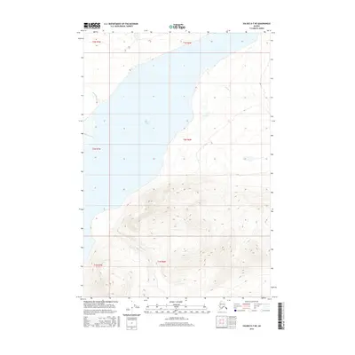
2016 Map of Valdez D-7 NE
USGS Topo · Published 2016About this map
Tazlina Lake dominates the central portion of this 2016 survey, serving as a significant hydrological focal point for the surrounding glacial-fed drainage systems. Located within the Copper River basin, the landscape is defined by the influx of the Nelchina River from the west and the outgoing flow of tributary streams. Smaller waterways such as Kaina Cr and Mendeltna Cr converge in this transition zone between the low-lying lake basin and the rising topography to the south. The southern half of the map shows a dramatic shift in elevation, where the headwaters of Tokatina Cr originate. This high-altitude terrain illustrates the complex watershed patterns that feed the larger river systems of the Unorganized Borough, providing a detailed look at the hydrology before these waters reach the Copper River.
Find a feature on this map
11 named features on this map. Tap any name to fly to it.
Don’t see what you’re looking for? This feature index may not catch every label — zoom into the map to look around manually.
Map Details
Editions of this 2016 Valdez D-7 NE Map
This is the sole edition of this map. No revisions or reprints were ever made.
Other maps of this area

1949 · Gulkana A-5
USGS Topo · 1:63,360

1949 · Valdez D-6
USGS Topo · 1:63,360

1949 · Valdez D-7
USGS Topo · 1:63,360

1951 · Gulkana
USGS Topo · 1:250,000

1951 · Valdez D-6
USGS Topo · 1:63,360

1951 · Valdez D-7
USGS Topo · 1:63,360

1952 · Valdez
USGS Topo · 1:250,000

1952 · Gulkana A-5
USGS Topo · 1:63,360

1959 · Gulkana
USGS Topo · 1:250,000

1960 · Valdez
USGS Topo · 1:250,000