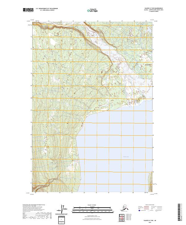
2023 Map of Valdez D-7 NW
USGS Topo · Published 2023About this map
Nelchina River winds across the northern reaches of this landscape, its braided channels and gravel bars defining the drainage patterns north of the massive Tazlina Lake. The settlement of Mendeltna serves as the primary human landmark in this Copper River Census Area terrain, situated where the waters of Mendeltna Creek feed into the regional river system. The geography is characterized by the expansive shoreline of Tazlina Lake in the southeast, contrasting with the complex wetland and riverine environments to the north. These waterways historically influenced seasonal movement and subsistence in the region, with the river corridors providing natural pathways through the interior of Alaska.
Find a feature on this map
10 named features on this map. Tap any name to fly to it.
Don’t see what you’re looking for? This feature index may not catch every label — zoom into the map to look around manually.
Map Details
Editions of this 2023 Valdez D-7 NW Map
This is the sole edition of this map. No revisions or reprints were ever made.
Other maps of this area

1949 · Gulkana A-5
USGS Topo · 1:63,360

1949 · Gulkana A-6
USGS Topo · 1:63,360

1949 · Valdez D-8
USGS Topo · 1:63,360

1949 · Valdez D-7
USGS Topo · 1:63,360

1951 · Gulkana
USGS Topo · 1:250,000

1951 · Valdez D-7
USGS Topo · 1:63,360

1952 · Valdez D-8
USGS Topo · 1:63,360

1952 · Valdez
USGS Topo · 1:250,000

1952 · Gulkana A-5
USGS Topo · 1:63,360
1952 · Gulkana A-6
USGS Topo · 1:63,360