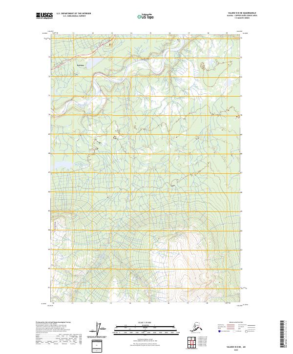
2023 Map of Valdez D-8 NE
USGS Topo · Published 2023About this map
The Nelchina River winds through this interior landscape, defining a corridor of drainage that includes Bentley Creek and the southern slopes of Heavenly Ridge. The settlement patterns here are minimal, concentrated near the historic Glenn Highway which traverses the northern section of the map through Nelchina. This area represents a rugged expanse of the Copper River Census Area where the geography is dictated by glacial runoff and high ridges. The map illustrates the sparse infrastructure characteristic of this region, where the primary human footprint is the single highway route connecting the interior to the coast, leaving much of the terrain to the natural courses of the river and its tributaries.
Find a feature on this map
11 named features on this map. Tap any name to fly to it.
Don’t see what you’re looking for? This feature index may not catch every label — zoom into the map to look around manually.
Map Details
Editions of this 2023 Valdez D-8 NE Map
This is the sole edition of this map. No revisions or reprints were ever made.
Other maps of this area

1949 · Gulkana A-6
USGS Topo · 1:63,360

1949 · Valdez D-8
USGS Topo · 1:63,360

1949 · Valdez D-7
USGS Topo · 1:63,360

1951 · Gulkana
USGS Topo · 1:250,000

1951 · Valdez D-7
USGS Topo · 1:63,360

1952 · Valdez D-8
USGS Topo · 1:63,360

1952 · Valdez
USGS Topo · 1:250,000
1952 · Gulkana A-6
USGS Topo · 1:63,360

1959 · Gulkana
USGS Topo · 1:250,000

1960 · Valdez
USGS Topo · 1:250,000