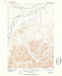
1952 Map of Valdez D-8
USGS Topo · Published 1952About this map
The Glenn Highway cuts through the northern reaches of this Alaskan interior landscape, providing a critical transport artery between the high peaks and river valleys. This 1952 survey, based on aerial photography from 1948, illustrates a territory defined by the braided courses of the Nelchina River and the Little Nelchina River. The landscape is dominated by high-elevation survey markers like Vabm 5854 Black and Vabm 4822 Shale, which denote the prominent peaks south of the road. Remote survival is evidenced by several Cabins and a lone Cabin positioned near the water and high ridges. The presence of Twin Lakes and various smaller water bodies nestled in the river bends highlights the drainage patterns of this subarctic environment before significant modern development altered the backcountry access points.
Find a feature on this map
15 named features on this map. Tap any name to fly to it.
Don’t see what you’re looking for? This feature index may not catch every label — zoom into the map to look around manually.
Map Details
Editions of this 1952 Valdez D-8 Map
2 editions found

Other maps of this area

1948 · Anchorage D-1
USGS Topo · 1:63,360

1949 · Talkeetna Mountains A-1
USGS Topo · 1:63,360

1949 · Gulkana A-6
USGS Topo · 1:63,360

1949 · Valdez D-8
USGS Topo · 1:63,360

1949 · Valdez D-7
USGS Topo · 1:63,360

1950 · Talkeetna Mountains
USGS Topo · 1:250,000

1951 · Gulkana
USGS Topo · 1:250,000

1951 · Valdez D-7
USGS Topo · 1:63,360

1951 · Anchorage
USGS Topo · 1:250,000

1951 · Anchorage D-1
USGS Topo · 1:63,360