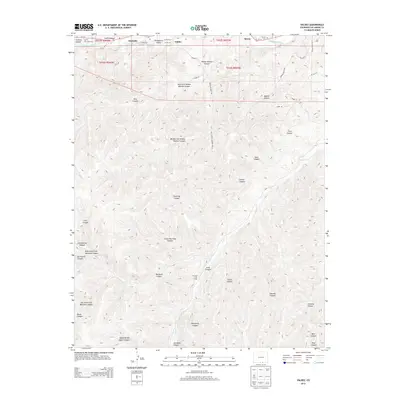
2013 Map of Valdez
USGS Topo · Published 2013About this map
Purgatoire River waters define the northern boundary of this landscape, where the settlements of Segundo, Picketwire Valley, and Valdez are concentrated along the river corridor. To the south, the terrain transforms into an intricate system of deep drainages and ridges, featuring several branches of Widow Woman Canyon and the notable Penitente Canyon. Family history is anchored in the valley at sites such as San Juan Cem and Tijeras Cem, as well as the outlier settlement of Tijeras. The interior of the map reflects a more isolated ranching or pastoral life, evidenced by Parsons Cow Camp and numerous named canyons like Sowbelly Canyon and Madrid Canyon. The presence of roads like Co-12 and primitive routes such as N Fork Trl show the historical access points into this complex topography south of the river valley.
Find a feature on this map
54 named features on this map. Tap any name to fly to it.
Don’t see what you’re looking for? This feature index may not catch every label — zoom into the map to look around manually.
Map Details
Editions of this 2013 Valdez Map
This is the sole edition of this map. No revisions or reprints were ever made.
Other maps of this area

1891 · Spanish Peaks
USGS Topo · 1:125,000

1893 · Spanish Peaks
USGS Topo · 1:125,000

1895 · Spanish Peaks
USGS Topo · 1:125,000

1897 · Spanish Peaks
USGS Topo · 1:125,000

1900 · Spanish Peaks
USGS Topo · 1:125,000

1915 · Brilliant
USGS Topo · 1:62,500

1951 · Trinidad
USGS Topo · 1:24,000

1951 · Valdez
USGS Topo · 1:24,000

1951 · Madrid
USGS Topo · 1:24,000
1951 · Starkville
USGS Topo · 1:24,000