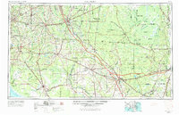
1954 Map of Valdosta
USGS Topo · Published 1967About this map
The Georgia Florida borderlands are defined by the intricate hydrology of the Okefenokee Swamp and a network of blackwater rivers including the Suwannee River and Withlacoochee River. This mid-century survey reveals a landscape where rail lines like the Atlantic Coast Line and the Seaboard Air Line still functioned as vital arteries connecting timber towns and agricultural hubs. In the west, Thomasville and Valdosta anchor the Georgia side, while Lake City and Live Oak serve as regional centers in Florida. The map documents significant military and conservation footprints, from Moody Air Force Base near Bemiss to the massive expanse of the Osceola National Forest. Cultural landmarks like the Olustee Battlefield Monument and rural congregational sites such as Paradise Church and Zion Church provide specific points of interest for local historians and genealogists tracing the development of the Suwannee Valley region.
Find a feature on this map
205 named features on this map. Tap any name to fly to it.
Don’t see what you’re looking for? This feature index may not catch every label — zoom into the map to look around manually.
Map Details
Editions of this 1954 Valdosta Map
2 editions found

Other maps of this area

1917 · Nahunta
USGS Topo · 1:62,500

1917 · Cambon
USGS Topo · 1:62,500

1917 · Boulogne
USGS Topo · 1:62,500

1917 · Macclenny
USGS Topo · 1:62,500

1917 · Hilliard
USGS Topo · 1:62,500

1918 · Folkston
USGS Topo · 1:62,500

1918 · Middleburg
USGS Topo · 1:62,500

1918 · Moniac
USGS Topo · 1:62,500

1918 · Lawtey
USGS Topo · 1:62,500

1918 · Nahunta
USGS Topo · 1:62,500