
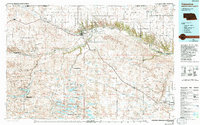
1985 Map of Valentine
USGS Topo · Published 1985About this map
Valentine and its surrounding sandhills dominate this mid-1980s landscape, where the Niobrara River and Snake River carve through the plains of northern Nebraska. The region's focus on conservation and water management is evident in the expansive Valentine National Wildlife Refuge and the Merritt Reservoir State Recreation Area, which serves the Gordon Canal. The terrain is punctuated by numerous lakes such as Big Alkali Lake and Watts Lake, illustrating the unique hydrology of the Sandhills region.
Find a feature on this map
96 named features on this map. Tap any name to fly to it.
Don’t see what you’re looking for? This feature index may not catch every label — zoom into the map to look around manually.
Map Details
Editions of this 1985 Valentine Map
2 editions found
Other maps of this area

1949 · Big Falls
USGS Topo · 1:62,500

1949 · Long Lake
USGS Topo · 1:62,500

1950 · Norden
USGS Topo · 1:62,500

1950 · Huddle Table
USGS Topo · 1:24,000

1950 · Sparks
USGS Topo · 1:62,500

1950 · Simeon
USGS Topo · 1:62,500

1950 · Powderhorn Valley
USGS Topo · 1:62,500

1950 · Kennedy
USGS Topo · 1:62,500

1950 · Kilgore
USGS Topo · 1:62,500

1950 · Wood Lake
USGS Topo · 1:62,500