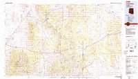
1984 Map of Valentine
USGS Topo · Published 1984About this map
The Atchison Topeka and Santa Fe railroad serves as a central artery for northern Arizona's high desert on this 1980s-era sheet, following a path through Valentine, Hackberry, and Crozier. This transit corridor is flanked by the Peacock Mountains and the Cottonwood Mountains, where significant mining operations such as the North Hackberry Mine and Sunshine Mine indicate the region's enduring mineral extraction history. The landscape is defined by vast rangelands and tribal territories, including the southern portion of the Hualapai Indian Reservation.
Find a feature on this map
47 named features on this map. Tap any name to fly to it.
Don’t see what you’re looking for? This feature index may not catch every label — zoom into the map to look around manually.
Map Details
Editions of this 1984 Valentine Map
2 editions found
Other maps of this area

1886 · Diamond Creek
USGS Topo · 1:250,000

1886 · Camp Mohave
USGS Topo · 1:250,000

1886 · Chino
USGS Topo · 1:250,000

1887 · Prescott
USGS Topo · 1:250,000

1891 · Chino
USGS Topo · 1:250,000

1892 · Diamond Creek
USGS Topo · 1:250,000

1892 · Camp Mohave
USGS Topo · 1:250,000

1892 · Prescott
USGS Topo · 1:250,000

1923 · Signal
USGS Topo · 1:250,000

1927 · Yucca
USGS Topo · 1:62,500