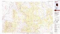
1984 Map of Valentine
USGS Topo · Published 1984About this map
Valentine and Hackberry sit as central hubs in this desert landscape during the mid-1980s, where the historic path of Route 66 meets the industrial reach of the Atchison Topeka and Santa Fe railroad. The map documents a transition between the open expanses of the Hualapai Valley and the uplifted terrain of the Peacock Mountains and Cottonwood Mountains.
Find a feature on this map
61 named features on this map. Tap any name to fly to it.
Don’t see what you’re looking for? This feature index may not catch every label — zoom into the map to look around manually.
Map Details
Editions of this 1984 Valentine Map
2 editions found
Other maps of this area

1886 · Diamond Creek
USGS Topo · 1:250,000

1886 · Camp Mohave
USGS Topo · 1:250,000

1886 · Chino
USGS Topo · 1:250,000

1887 · Prescott
USGS Topo · 1:250,000

1891 · Chino
USGS Topo · 1:250,000

1892 · Diamond Creek
USGS Topo · 1:250,000

1892 · Camp Mohave
USGS Topo · 1:250,000

1892 · Prescott
USGS Topo · 1:250,000

1923 · Signal
USGS Topo · 1:250,000

1927 · Yucca
USGS Topo · 1:62,500