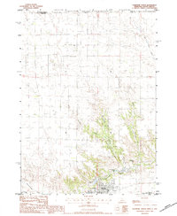
1983 Map of Valentine North
USGS Topo · Published 1984About this map
The Rosebud Indian Reservation spans the northern portion of this landscape, meeting the South Dakota Nebraska border just above the drainage of Beaver Creek. Near the southern edge of the sheet, the town of Valentine serves as a hub for both transportation and conservation, situated along the C & NW railroad and Minnechadua Creek. This area is characterized by the transition from open prairie to the deeply carved Canyon terrain that shelters the Valentine State Fish Hatchery and Fish Hatchery Lake. Local life and genealogy are anchored by rural institutions like the New Harmony Sch and the Richland Harmony Cem to the north, while Frederick Peak provides a prominent landmark overlooking the valley. The presence of the Fort Niobrara National Wildlife Refuge underscores the region's focus on preserving the unique riverine environment of the Niobrara valley.
Find a feature on this map
22 named features on this map. Tap any name to fly to it.
Don’t see what you’re looking for? This feature index may not catch every label — zoom into the map to look around manually.
Map Details
Editions of this 1983 Valentine North Map
2 editions found
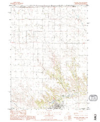
Other maps of this area

1950 · Sparks
USGS Topo · 1:62,500

1950 · Valentine
USGS Topo · 1:62,500

1955 · Martin
USGS Topo · 1:250,000

1957 · Valentine
USGS Topo · 1:250,000

1958 · Martin
USGS Topo · 1:250,000

1959 · Valentine
USGS Topo · 1:250,000

1969 · Olsonville SW
USGS Topo · 1:24,000

1982 · Olsonville SE
USGS Topo · 1:24,000
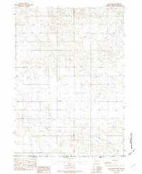
1982 · Littleburg
USGS Topo · 1:24,000

1982 · Mission
USGS Topo · 1:100,000