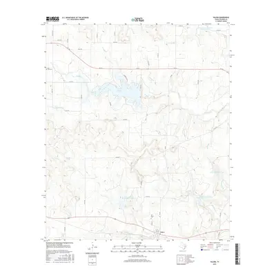
2016 Map of Valera
USGS Topo · Published 2016About this map
Valera anchors the southern portion of this landscape, where the local road network of Young St and 2nd St converges near the watercourses of Home Cr and Bead Mountain Cr. The area reflects a history of small-town settlement and rural land management, evidenced by the presence of both the Old Valera Cem and the Glen Cove Cem to the northwest. Water management is a defining characteristic of this terrain, with Hords Cr Lake serving as a significant geographical feature alongside numerous specialized basins like Soil Conservation Service Site 36 Reservoir. The distribution of these reservoirs and springs, such as Post Oak Spring, suggests a landscape shaped by the necessity of reliable water access for livestock and local agriculture in Coleman County. A network of ranch roads and state highways like FM 153 connects these remote points of interest across the varied topography of the Mustang Br and McCall Br drainages.
Find a feature on this map
50 named features on this map. Tap any name to fly to it.
Don’t see what you’re looking for? This feature index may not catch every label — zoom into the map to look around manually.
Map Details
Editions of this 2016 Valera Map
This is the sole edition of this map. No revisions or reprints were ever made.
Other maps of this area

1887 · Coleman
USGS Topo · 1:125,000

1889 · Coleman
USGS Topo · 1:125,000

1892 · Ballinger
USGS Topo · 1:125,000

1932 · Voss
USGS Topo · 1:62,500

1954 · Brownwood
USGS Topo · 1:250,000

1960 · Lake Scarborough
USGS Topo · 1:24,000
1963 · Coleman
USGS Topo · 1:24,000
1964 · Fisk
USGS Topo · 1:24,000

1967 · Talpa
USGS Topo · 1:24,000

1967 · Novice West
USGS Topo · 1:24,000