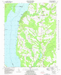
1982 Map of Valhalla
USGS Topo · Published 1982About this map
Arrowhead Beach and Chowan Beach characterize the developed shoreline of the Chowan River in the early 1980s, where residential pockets meet the expansive waterways of eastern North Carolina. Inland, the map reveals a landscape defined by agricultural persistence and a network of traditional community centers. Numerous country churches and educational landmarks, such as Rockyhock Ch, Ballards Bridge Ch, and Chowan Academy, serve as historical anchors for the surrounding rural residents.
Find a feature on this map
45 named features on this map. Tap any name to fly to it.
Don’t see what you’re looking for? This feature index may not catch every label — zoom into the map to look around manually.
Map Details
Editions of this 1982 Valhalla Map
This is the sole edition of this map. No revisions or reprints were ever made.
Other maps of this area

1904 · Edenton
USGS Topo · 1:62,500

1906 · Beckford
USGS Topo · 1:48,000

1907 · Beckford
USGS Topo · 1:62,500

1908 · Winton
USGS Topo · 1:62,500

1940 · Beckford
USGS Topo · 1:62,500

1942 · Edenton
USGS Topo · 1:62,500

1943 · Edenton
USGS Topo · 1:62,500

1953 · Norfolk
USGS Topo · 1:250,000
1981 · Edenton
USGS Topo · 1:24,000
1982 · Mintonsville
USGS Topo · 1:24,000