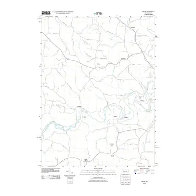
2010 Map of Valier
USGS Topo · Published 2010About this map
Mahoning Creek winds through the southern reaches of this Jefferson County landscape, creating the western basin of Mahoning Creek Lake. The area's industrial legacy is subtly indicated by the presence of Mine Number 8 near Horatio, while the rural aviation history of the region is preserved at Wainwrights Landing Strip. The map is dotted with small, dispersed settlements including Valier, Fordham, and Trade City, each serving as a local hub for the surrounding farmsteads. Genealogists will find several burial grounds across the township, such as Saints Peter and Paul Cemetery and White Church Cemetery. The network of local roads like Sprankle Mills Rd and Hamilton-Markton Rd connects these hamlets, following the contours of the many runs and creeks like Big Run and Dutch Run.
Find a feature on this map
97 named features on this map. Tap any name to fly to it.
Don’t see what you’re looking for? This feature index may not catch every label — zoom into the map to look around manually.
Map Details
Editions of this 2010 Valier Map
This is the sole edition of this map. No revisions or reprints were ever made.
Other maps of this area

1906 · Punxsutawney
USGS Topo · 1:62,500

1909 · Smicksburg
USGS Topo · 1:62,500

1922 · Du Bois
USGS Topo · 1:62,500

1924 · Du Bois
USGS Topo · 1:62,500

1924 · Brookville
USGS Topo · 1:62,500

1926 · Brookville
USGS Topo · 1:62,500

1938 · Smicksburg
USGS Topo · 1:62,500

1939 · Smicksburg
USGS Topo · 1:62,500

1939 · Punxsutawney
USGS Topo · 1:62,500

1942 · Punxsutawney
USGS Topo · 1:62,500
Featured Places
- McCalmont Township, PA
- Frostburg, Perry Township
- West Mahoning Township, PA
- North Mahoning Township, PA
- Perry Township, PA