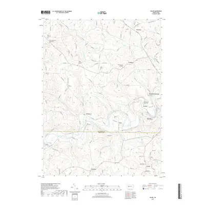
2019 Map of Valier
USGS Topo · Published 2019About this map
Mahoning Creek winds through the borderlands of Jefferson and Indiana counties, anchoring a landscape of rural hamlets and deeply rooted religious sites. This area is characterized by numerous small settlements such as Valier, Hamilton, and Oliveburg, each connected by a dense network of country roads like N Enterline Rd and State Rte 4028. The distribution of family and denominational burial grounds, including the Saint Johns Reformed United Church of Christ Cem and Saints Peter And Paul Byzantine Catholic Cem, speaks to the strong genealogical heritage of these Pennsylvania townships. Local landmarks like Round Top and Granny Coon Spring punctuate the terrain, while numerous runs such as Perryville Run and Nicely Run drain into the central creek valley. The proximity of the western edge of Punxsutawney at Horatio provides a glimpse into the regional commerce of the early 21st century.
Find a feature on this map
143 named features on this map. Tap any name to fly to it.
Don’t see what you’re looking for? This feature index may not catch every label — zoom into the map to look around manually.
Map Details
Editions of this 2019 Valier Map
This is the sole edition of this map. No revisions or reprints were ever made.
Other maps of this area

1906 · Punxsutawney
USGS Topo · 1:62,500

1909 · Smicksburg
USGS Topo · 1:62,500

1922 · Du Bois
USGS Topo · 1:62,500

1924 · Du Bois
USGS Topo · 1:62,500

1924 · Brookville
USGS Topo · 1:62,500

1926 · Brookville
USGS Topo · 1:62,500

1938 · Smicksburg
USGS Topo · 1:62,500

1939 · Smicksburg
USGS Topo · 1:62,500

1939 · Punxsutawney
USGS Topo · 1:62,500

1942 · Punxsutawney
USGS Topo · 1:62,500
Featured Places
- McCalmont Township, PA
- Frostburg, Perry Township
- West Mahoning Township, PA
- North Mahoning Township, PA
- Perry Township, PA