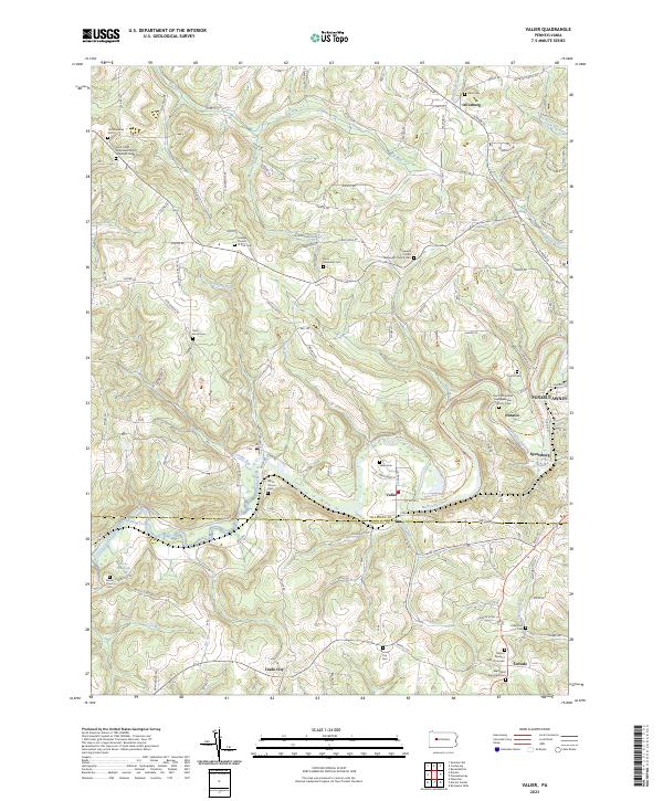
2023 Map of Valier
USGS Topo · Published 2023About this map
Mahoning Creek winds through the heart of this landscape, marking the boundary between Jefferson and Indiana counties. The area is defined by a dense network of small rural settlements such as Trade City, Oliveburg, and Valier, many of which grew around the intersections of early township roads and creeks. The map provides significant genealogical value, documenting numerous denominational landmarks like the Saint Johns Reformed United Church of Christ Cem and the Methodist Episcopal Cem. Near the eastern edge, the transition from rural valley to the industrial outskirts of Punxsutawney is evident as the Mahoning Shadow Trl follows the path of former rail infrastructure through Horatio and Sportsburg. This documentation of cemeteries and small-scale settlements preserves the spatial history of family-named landmarks like Perry Memorial Cem and Mount Pleasant Cem of Covode within their original rural context.
Find a feature on this map
141 named features on this map. Tap any name to fly to it.
Don’t see what you’re looking for? This feature index may not catch every label — zoom into the map to look around manually.
Map Details
Editions of this 2023 Valier Map
This is the sole edition of this map. No revisions or reprints were ever made.
Other maps of this area

1906 · Punxsutawney
USGS Topo · 1:62,500

1909 · Smicksburg
USGS Topo · 1:62,500

1922 · Du Bois
USGS Topo · 1:62,500

1924 · Du Bois
USGS Topo · 1:62,500

1924 · Brookville
USGS Topo · 1:62,500

1926 · Brookville
USGS Topo · 1:62,500

1938 · Smicksburg
USGS Topo · 1:62,500

1939 · Smicksburg
USGS Topo · 1:62,500

1939 · Punxsutawney
USGS Topo · 1:62,500

1942 · Punxsutawney
USGS Topo · 1:62,500
Featured Places
- McCalmont Township, PA
- Perry Township, PA
- North Mahoning Township, PA
- Covode, North Mahoning Township
- Horatio, Young Township