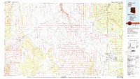
1983 Map of Valle
USGS Topo · Published 1983About this map
Valle serves as a focal point in this high-desert landscape, where the Atchison Topeka and Santa Fe railroad line stretches toward the south. The terrain is defined by the massive drainage system of Cataract Canyon and its many tributaries, such as Coconino Wash and Red Horse Wash, which carve through the Coconino Plateau. The presence of the Copper Queen Mine and various Cinder Pits near Howard Hill points to the area's geological and industrial utility during the early 1980s.
Find a feature on this map
36 named features on this map. Tap any name to fly to it.
Don’t see what you’re looking for? This feature index may not catch every label — zoom into the map to look around manually.
Map Details
Editions of this 1983 Valle Map
3 editions found
Other maps of this area

1886 · Diamond Creek
USGS Topo · 1:250,000

1886 · San Francisco Mtns
USGS Topo · 1:250,000

1886 · Mt. Trumbull
USGS Topo · 1:250,000

1886 · Chino
USGS Topo · 1:250,000

1886 · Echo Cliffs
USGS Topo · 1:250,000

1886 · Kaibab
USGS Topo · 1:250,000

1891 · San Francisco Mtns
USGS Topo · 1:250,000

1891 · Chino
USGS Topo · 1:250,000

1891 · Echo Cliffs
USGS Topo · 1:250,000

1892 · Diamond Creek
USGS Topo · 1:250,000