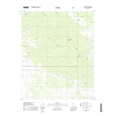
2020 Map of Valle Largo
USGS Topo · Published 2020About this map
The Continental Divide winds through this high-altitude landscape in the Cibola National Forest, defining the watershed between the Zuñi Mountains and the canyon-cut terrain to the east. The small settlement of Aragon sits at the northeastern edge of the sheet, while the open expanse of Valle Largo occupies the western valley floor. The map documents a rugged interior reliant on seasonal water sources and stock management, as evidenced by several named springs and tanks, including Mule Spring, Ojo Bonito, and the Temporary Stock Tank. To the south, Monument Lake and the Laguna de la Choza provide rare permanent water features. A network of forest and motorized roads, such as Motorized 321 and Tinaja Rd, provides the primary access through the steep relief of Oso Ridge and Rivera Canyon.
Find a feature on this map
43 named features on this map. Tap any name to fly to it.
Don’t see what you’re looking for? This feature index may not catch every label — zoom into the map to look around manually.
Map Details
Editions of this 2020 Valle Largo Map
This is the sole edition of this map. No revisions or reprints were ever made.
Other maps of this area

1886 · Wingate
USGS Topo · 1:250,000

1892 · Wingate
USGS Topo · 1:250,000

1951 · Mt Sedgwick
USGS Topo · 1:24,000

1952 · Valle Largo
USGS Topo · 1:24,000

1952 · Post Office Flat
USGS Topo · 1:24,000

1952 · Paxton Springs
USGS Topo · 1:24,000

1954 · Saint Johns
USGS Topo · 1:250,000

1954 · Gallup
USGS Topo · 1:250,000

1957 · Saint Johns
USGS Topo · 1:250,000

1958 · Gallup
USGS Topo · 1:250,000