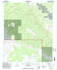
1995 Map of Valle Largo
USGS Topo · Published 1998About this map
The Continental Divide winds through this high-altitude landscape where the Zuni Mountains meet the Oso Ridge. This remote New Mexico terrain is characterized by a sparse but vital network of water sources, including Ojo Bonito Spring, Alamosa Spring, and Aragon Spring. While much of the land is protected within the Cibola National Forest and the El Malpais Nat Conservation Area, signs of human activity are present at the Valle Largo Cabin and the Aragon Ranch.
Find a feature on this map
34 named features on this map. Tap any name to fly to it.
Don’t see what you’re looking for? This feature index may not catch every label — zoom into the map to look around manually.
Map Details
Editions of this 1995 Valle Largo Map
This is the sole edition of this map. No revisions or reprints were ever made.
Other maps of this area

1886 · Wingate
USGS Topo · 1:250,000

1892 · Wingate
USGS Topo · 1:250,000

1951 · Mt Sedgwick
USGS Topo · 1:24,000

1952 · Valle Largo
USGS Topo · 1:24,000

1952 · Post Office Flat
USGS Topo · 1:24,000

1952 · Paxton Springs
USGS Topo · 1:24,000

1954 · Saint Johns
USGS Topo · 1:250,000

1954 · Gallup
USGS Topo · 1:250,000

1957 · Saint Johns
USGS Topo · 1:250,000

1958 · Gallup
USGS Topo · 1:250,000