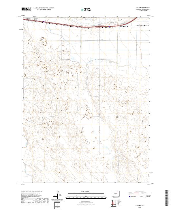
2022 Map of Vallery
USGS Topo · Published 2022About this map
Bijou Creek and the Bijou Canal define this landscape on the Colorado plains, where water management is central to the land's utility. The northern reaches of the quadrangle are oriented around transportation and utility infrastructure, featuring Frontage Rd and the appropriately named Energy Rd. These corridors provide a stark contrast to the vast section-line grid that dominates the remainder of the territory. The presence of Kent Airport at the northern edge suggests a hub for local aviation or agricultural operations within Morgan County. Moving south, the terrain is shaped by ephemeral drainages like Sand Arroyo Cr, illustrating the sparse, dry environment where seasonal water flow dictates the shape of the land. This grid system, evidenced by numerous county roads such as Co Rd 8 and Co Rd 900, reveals a landscape meticulously divided for ranching or dryland farming.
Find a feature on this map
25 named features on this map. Tap any name to fly to it.
Don’t see what you’re looking for? This feature index may not catch every label — zoom into the map to look around manually.
Map Details
Editions of this 2022 Vallery Map
This is the sole edition of this map. No revisions or reprints were ever made.
Other maps of this area

1950 · Wiggins
USGS Topo · 1:24,000

1950 · Hoyt
USGS Topo · 1:24,000

1951 · Hoyt
USGS Topo · 1:24,000

1951 · Weldona
USGS Topo · 1:24,000

1951 · Orchard
USGS Topo · 1:24,000

1951 · Fort Morgan
USGS Topo · 1:24,000

1954 · Sterling
USGS Topo · 1:250,000

1954 · Greeley
USGS Topo · 1:250,000

1957 · Greeley
USGS Topo · 1:250,000

1958 · Greeley
USGS Topo · 1:250,000