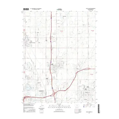
2015 Map of Valley Center
USGS Topo · Published 2015About this map
The Little Arkansas River meanders through the western portion of this Sedgwick County landscape, where the northern expansion of Wichita meets a series of suburban and rural communities. In this mid-2010s survey, the area around Valley Center and Park City is defined by a dense grid of residential streets and arterial roads, including a significant network of small airfields such as Curtis Airport and Hidden Valley Airport. Local history is anchored by established burial grounds like Marble Grove Cem and Kechi Cem, while the hydrological landscape is dominated by the various branches of Chisholm Creek, including the W Fork Chisholm Cr and Middle Fork Chisholm Cr. The map captures the interface between industrial corridors, residential pockets like Arthur Heights, and the open agricultural sections of the T25S and T26S survey ranges.
Find a feature on this map
66 named features on this map. Tap any name to fly to it.
Don’t see what you’re looking for? This feature index may not catch every label — zoom into the map to look around manually.
Map Details
Editions of this 2015 Valley Center Map
This is the sole edition of this map. No revisions or reprints were ever made.
Other maps of this area

1889 · Wichita
USGS Topo · 1:125,000

1894 · Wichita
USGS Topo · 1:125,000

1941 · Maize
USGS Topo · 1:31,680

1941 · Valley Center
USGS Topo · 1:31,680

1942 · Valley Center
USGS Topo · 1:31,680

1942 · Maize
USGS Topo · 1:31,680

1943 · Wichita West
USGS Topo · 1:31,680

1943 · Wichita East
USGS Topo · 1:31,680

1945 · Andover
USGS Topo · 1:31,680

1955 · Greenwich
USGS Topo · 1:24,000