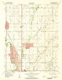
1956 Map of Valley Center
USGS Topo · Published 1957About this map
The Little Arkansas River and the branching forks of Chisholm Creek define the landscape north of Wichita in the mid-1950s. This territory is a dense network of steam-era rail lines and burgeoning suburban plats, where the Atchison Topeka and Santa Fe and the Chicago Rock Island and Pacific railroads bisect small town sites and industrial zones. The transition from agricultural land to residential development is evident in the cluster of schoolhouses and rural landmarks, including the Hillside Grove Sch and Chisholm Trail Sch, alongside established cemeteries like Marble Grove Cem.
Find a feature on this map
40 named features on this map. Tap any name to fly to it.
Don’t see what you’re looking for? This feature index may not catch every label — zoom into the map to look around manually.
Map Details
Editions of this 1956 Valley Center Map
This is the sole edition of this map. No revisions or reprints were ever made.
Other maps of this area

1889 · Wichita
USGS Topo · 1:125,000

1894 · Wichita
USGS Topo · 1:125,000

1941 · Maize
USGS Topo · 1:31,680

1941 · Valley Center
USGS Topo · 1:31,680

1942 · Valley Center
USGS Topo · 1:31,680

1942 · Maize
USGS Topo · 1:31,680

1943 · Wichita West
USGS Topo · 1:31,680

1943 · Wichita East
USGS Topo · 1:31,680

1945 · Andover
USGS Topo · 1:31,680

1955 · Greenwich
USGS Topo · 1:24,000