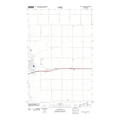
2011 Map of Valley City East
USGS Topo · Published 2011About this map
The Sheyenne River meanders through the western portion of this landscape, anchoring the eastern outskirts of the regional hub. In this early 21st-century record, the transition from urban streets to the expansive section-line grid of Barnes County is clearly visible. The area around North Valley City shows a dense network of local roads including Chautauqua Blvd and Valley Ave, while further east, the small settlement of Peak sits near the Peak Interchange.
Find a feature on this map
43 named features on this map. Tap any name to fly to it.
Don’t see what you’re looking for? This feature index may not catch every label — zoom into the map to look around manually.
Map Details
Editions of this 2011 Valley City East Map
This is the sole edition of this map. No revisions or reprints were ever made.
Other maps of this area

1897 · Tower
USGS Topo · 1:125,000

1897 · Eckelson
USGS Topo · 1:125,000

1952 · Grand Forks
USGS Topo · 1:250,000

1952 · New Rockford
USGS Topo · 1:250,000

1953 · Jamestown
USGS Topo · 1:250,000

1953 · Fargo
USGS Topo · 1:250,000

1956 · New Rockford
USGS Topo · 1:250,000

1956 · Fargo
USGS Topo · 1:250,000

1956 · Jamestown
USGS Topo · 1:250,000

1956 · Grand Forks
USGS Topo · 1:250,000