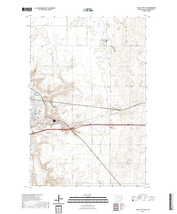
2024 Map of Valley City East
USGS Topo · Published 2024About this map
The Sheyenne River winds through the eastern edge of Valley City, defining the local geography as the valley floor meets the surrounding uplands. This 2024 survey captures the community and its outlying agricultural surroundings, including the distinct area of North Valley City. The sheet is notable for its concentration of local heritage sites, including Saint Catherines Cem, Hillside Cem, and Memory Gardens Cem, providing a detailed record for genealogical research. To the north, the Barnes County Waterfowl Production Area preserves a significant portion of the prairie pothole region, where wetlands and small water bodies dot the landscape near Salem Methodist Church Cem. The terrain rises to a feature simply labeled Peak in the eastern portion of the quadrangle, overlooking the township grids of t140n r57w and t141n r57w.
Find a feature on this map
52 named features on this map. Tap any name to fly to it.
Don’t see what you’re looking for? This feature index may not catch every label — zoom into the map to look around manually.
Map Details
Editions of this 2024 Valley City East Map
This is the sole edition of this map. No revisions or reprints were ever made.
Other maps of this area

1897 · Tower
USGS Topo · 1:125,000

1897 · Eckelson
USGS Topo · 1:125,000

1952 · Grand Forks
USGS Topo · 1:250,000

1952 · New Rockford
USGS Topo · 1:250,000

1953 · Jamestown
USGS Topo · 1:250,000

1953 · Fargo
USGS Topo · 1:250,000

1956 · New Rockford
USGS Topo · 1:250,000

1956 · Fargo
USGS Topo · 1:250,000

1956 · Jamestown
USGS Topo · 1:250,000

1956 · Grand Forks
USGS Topo · 1:250,000