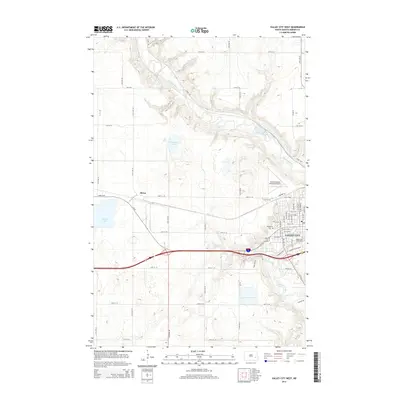
2014 Map of Valley City West
USGS Topo · Published 2014About this map
Valley City occupies the eastern portion of this 2014 survey, where the Sheyenne River carves a deep valley through the prairie landscape. The campus of Valley City State Univ and the Woodbine Cem are established landmarks within the city limits. Moving west across the upland flats, the small settlement of Berea sits along the rail line, while the Barnes County Municipal Airport and 4 Bottle Dr mark the intersection of aviation and rural development. The terrain is dotted with seasonal water bodies, most notably McDonald Lake and Hobart Lake, which reflect the region's glacial history. This map provides a clear view of the modern road network, including the local grid from Central Ave N to 118th Ave SE, showing how the community has expanded around the river's winding course.
Find a feature on this map
58 named features on this map. Tap any name to fly to it.
Don’t see what you’re looking for? This feature index may not catch every label — zoom into the map to look around manually.
Map Details
Editions of this 2014 Valley City West Map
This is the sole edition of this map. No revisions or reprints were ever made.
Other maps of this area

1897 · Tower
USGS Topo · 1:125,000

1897 · Eckelson
USGS Topo · 1:125,000

1952 · Grand Forks
USGS Topo · 1:250,000

1952 · New Rockford
USGS Topo · 1:250,000

1953 · Jamestown
USGS Topo · 1:250,000

1953 · Fargo
USGS Topo · 1:250,000

1956 · New Rockford
USGS Topo · 1:250,000

1956 · Fargo
USGS Topo · 1:250,000

1956 · Jamestown
USGS Topo · 1:250,000

1956 · Grand Forks
USGS Topo · 1:250,000