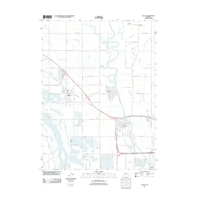
2011 Map of Valley
USGS Topo · Published 2011About this map
The Platte River and Elkhorn River converge in this section of Douglas County, creating a landscape defined by water and lowland drainage features like the Big Slough. The proximity of these major waterways has long influenced local settlement patterns, visible here in the clusters of Valley, Waterloo, and Elk City. Local heritage is anchored by sites such as the Elk City Cemetery and Prospect Hill Cemetery, while the area's transition into a more modern residential and recreational hub is marked by numerous man-made water bodies including Lake Clagus, Riverside Lakes, and Lake Taormina. Aviation history is represented by the Roger Airstrip, situated south of Valley. The map also shows the winding path of Rawhide Creek (Old Channel), illustrating how the shifting river morphology has shaped the geography of eastern Nebraska.
Find a feature on this map
56 named features on this map. Tap any name to fly to it.
Don’t see what you’re looking for? This feature index may not catch every label — zoom into the map to look around manually.
Map Details
Editions of this 2011 Valley Map
This is the sole edition of this map. No revisions or reprints were ever made.
Other maps of this area

1893 · Fremont
USGS Topo · 1:125,000

1896 · Fremont
USGS Topo · 1:125,000

1955 · Fremont
USGS Topo · 1:250,000

1956 · Gretna
USGS Topo · 1:24,000

1957 · Fremont
USGS Topo · 1:250,000

1958 · Fremont
USGS Topo · 1:250,000

1968 · Valley
USGS Topo · 1:24,000

1968 · Leshara
USGS Topo · 1:24,000

1968 · Fremont East
USGS Topo · 1:24,000

1968 · Kennard
USGS Topo · 1:24,000