
1968 Map of Leshara
USGS Topo · Published 1971About this map
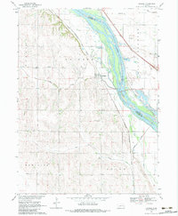
Leshara sits on the western terrace of the Platte River, a focal point of this late-1960s landscape where the river braids across the Douglas and Saunders County line. The terrain is defined by a dense network of Section-line roads and the presence of two major rail lines: the Chicago Burlington and Quincy and the Union Pacific, which parallel the river's course. Local life is centered around rural institutions like Pleasant View Cemetery and Little Flower Cemetery, alongside several numbered schools including School No 119 and School No 23.
Find a feature on this map
25 named features on this map. Tap any name to fly to it.
Don’t see what you’re looking for? This feature index may not catch every label — zoom into the map to look around manually.
Map Details
Editions of this 1968 Leshara Map
2 editions found
Other maps of this area

1893 · Fremont
USGS Topo · 1:125,000

1896 · Fremont
USGS Topo · 1:125,000

1899 · Wahoo
USGS Topo · 1:125,000

1955 · Fremont
USGS Topo · 1:250,000

1957 · Fremont
USGS Topo · 1:250,000

1958 · Fremont
USGS Topo · 1:250,000

1968 · Valley
USGS Topo · 1:24,000
1968 · Fremont West
USGS Topo · 1:24,000

1968 · Fremont East
USGS Topo · 1:24,000
1968 · Wann
USGS Topo · 1:24,000