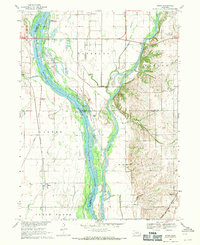
1968 Map of Wann
USGS Topo · Published 1971About this map
The Platte River and Elkhorn River converge in this 1960s landscape, creating a complex network of sandbars, islands, and floodplains. This area, largely defined by the Two Rivers State Recreation Area, shows a transition from the riparian lowlands of the river bottoms to the rolling hills of Forest City and Marble. The map captures the infrastructure of the late 1960s, including the Chicago Burlington and Quincy railroad line and the Chicago Rock Island and Pacific Railroad skirting the eastern edge near Gretna. Local history is preserved in the location of School No 24 and the Two Rivers Ch, alongside small aviation markers like Ruser Airfield. The drainage patterns are managed through the Diversion Channel and the Western Sarpy Ditch, reflecting the agricultural and recreational development of the Platte-Elkhorn junction.
Find a feature on this map
26 named features on this map. Tap any name to fly to it.
Don’t see what you’re looking for? This feature index may not catch every label — zoom into the map to look around manually.
Map Details
Editions of this 1968 Wann Map
2 editions found
Other maps of this area

1893 · Fremont
USGS Topo · 1:125,000

1896 · Fremont
USGS Topo · 1:125,000

1955 · Fremont
USGS Topo · 1:250,000

1956 · Gretna
USGS Topo · 1:24,000

1956 · Springfield
USGS Topo · 1:24,000

1957 · Fremont
USGS Topo · 1:250,000

1958 · Fremont
USGS Topo · 1:250,000

1968 · Valley
USGS Topo · 1:24,000
1968 · Ashland East
USGS Topo · 1:24,000

1968 · Leshara
USGS Topo · 1:24,000