1968 Map of Wann
USGS Topo · Published 1979About this map
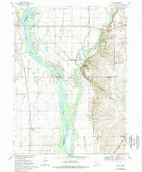
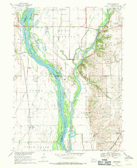
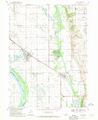
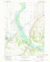
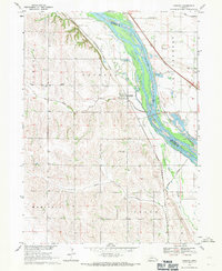
The Platte River and Elkhorn River converge in this eastern Nebraska landscape, forming a complex network of braids, sandbars, and agricultural bottomlands. The Two Rivers State Recreation Area dominates the central confluence, featuring numerous managed ponds and campgrounds alongside the Diversion Channel. While the higher ground to the east near Gretna shows the transition into rolling uplands, the lowland valley is defined by its transit history, including the corridors of the Union Pacific and the Chicago Burlington and Quincy railroads.
Find a feature on this map
25 named features on this map. Tap any name to fly to it.
Don’t see what you’re looking for? This feature index may not catch every label — zoom into the map to look around manually.
Map Details
Editions of this 1968 Wann Map
2 editions found
Other maps of this area

1893 · Fremont
USGS Topo · 1:125,000

1896 · Fremont
USGS Topo · 1:125,000

1955 · Fremont
USGS Topo · 1:250,000
1956 · Gretna
USGS Topo · 1:24,000
1956 · Springfield
USGS Topo · 1:24,000

1957 · Fremont
USGS Topo · 1:250,000

1958 · Fremont
USGS Topo · 1:250,000
1968 · Valley
USGS Topo · 1:24,000
1968 · Ashland East
USGS Topo · 1:24,000
1968 · Leshara
USGS Topo · 1:24,000