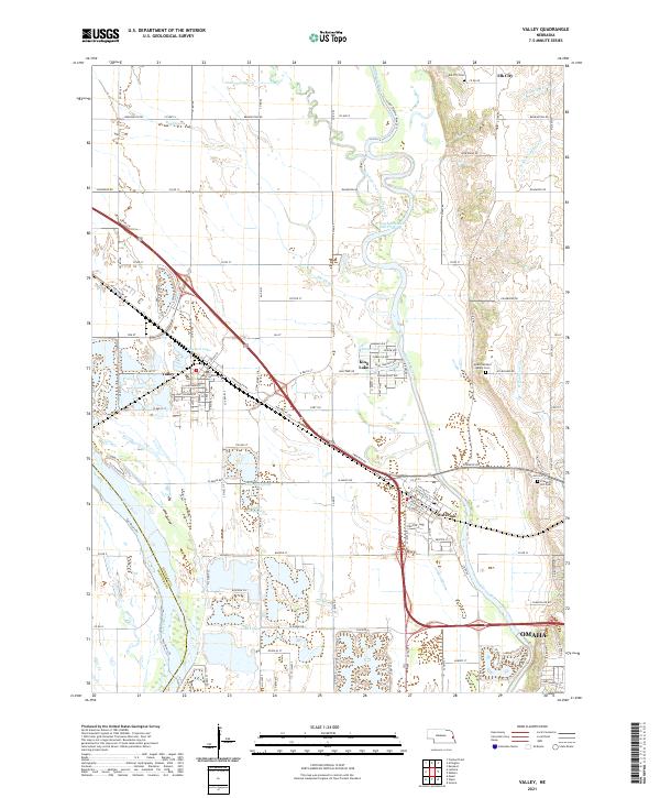
2021 Map of Valley
USGS Topo · Published 2021About this map
The confluence of the Elkhorn River and the Platte River defines the hydrologic character of this western Douglas County landscape. Broad floodplains are marked by abandoned channels like Rawhide Creek (Old Channel) and a series of sand-pit and recreational lakes including Pleasure Lake, Lake Taormina, and King's Lake. The settlement pattern follows the high ground and historic transport corridors between the rivers, where the community of Valley and the village of Waterloo serve as hubs for the surrounding agricultural tracts. On the eastern bluffs overlooking the Elkhorn valley, Elk City and several landmark burial grounds, such as Elk City Cem and Mount Michael Abbey Cem, provide focal points for local family history research. This contemporary survey captures the area as the northwestern outskirts of Omaha continue to influence the rural-to-suburban transition of the plains.
Find a feature on this map
126 named features on this map. Tap any name to fly to it.
Don’t see what you’re looking for? This feature index may not catch every label — zoom into the map to look around manually.
Map Details
Editions of this 2021 Valley Map
This is the sole edition of this map. No revisions or reprints were ever made.
Other maps of this area

1893 · Fremont
USGS Topo · 1:125,000

1896 · Fremont
USGS Topo · 1:125,000

1955 · Fremont
USGS Topo · 1:250,000

1956 · Gretna
USGS Topo · 1:24,000

1957 · Fremont
USGS Topo · 1:250,000

1958 · Fremont
USGS Topo · 1:250,000

1968 · Valley
USGS Topo · 1:24,000

1968 · Leshara
USGS Topo · 1:24,000

1968 · Fremont East
USGS Topo · 1:24,000

1968 · Kennard
USGS Topo · 1:24,000