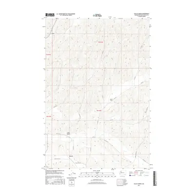
2017 Map of Valley Grove
USGS Topo · Published 2017About this map
Valley Grove and the surrounding agricultural landscapes of Walla Walla County are defined by a network of winding roads and the seasonal course of Dry Cr. The terrain is characterized by the complex contouring of the Palouse hills, where local routes like Hart Rd and N Clinton St follow the natural topography of the watershed. Small settlements and points of interest such as Ennis, Spring Valley, and Russell are dispersed throughout the region, connected by a thoroughfare system that includes Valley Grove Rd and Middle Waitsburg Rd.
Find a feature on this map
21 named features on this map. Tap any name to fly to it.
Don’t see what you’re looking for? This feature index may not catch every label — zoom into the map to look around manually.
Map Details
Editions of this 2017 Valley Grove Map
This is the sole edition of this map. No revisions or reprints were ever made.
Other maps of this area

1919 · Walla Walla
USGS Topo · 1:125,000

1921 · Walla Walla
USGS Topo · 1:125,000

1953 · Walla Walla
USGS Topo · 1:250,000

1958 · Walla Walla
USGS Topo · 1:250,000

1966 · Dixie
USGS Topo · 1:24,000
1966 · Buroker
USGS Topo · 1:24,000

1966 · Hadley
USGS Topo · 1:24,000

1966 · Valley Grove
USGS Topo · 1:24,000
1966 · Walla Walla
USGS Topo · 1:24,000
1966 · College Place
USGS Topo · 1:24,000