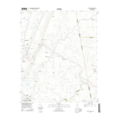
2014 Map of Valley Head
USGS Topo · Published 2014About this map
Big Wills Valley serves as a primary corridor for transportation and settlement in this portion of DeKalb County, Alabama. The landscape is defined by the parallel ridges of Big Ridge and Lookout Mountain, creating a complex drainage system where the West Fork Little River and its numerous tributaries like Stillhouse Br and Anna Br carve through the plateau. Local history is anchored by settlements such as Hammondville, Mentone, and Valley Head, with several family-named landmarks and cemeteries including Jones Cem and Holly Spring Cem dotting the terrain. The presence of Desoto State Park Lake and the northern edge of the Little River Canyon National Preserve highlights the intersection of public conservation and private community, while Cloudmont Airpark and Lake Howard reflect more modern land use patterns alongside established mountain communities.
Find a feature on this map
154 named features on this map. Tap any name to fly to it.
Don’t see what you’re looking for? This feature index may not catch every label — zoom into the map to look around manually.
Map Details
Editions of this 2014 Valley Head Map
This is the sole edition of this map. No revisions or reprints were ever made.
Other maps of this area

1886 · Ringgold
USGS Topo · 1:125,000

1886 · Rome
USGS Topo · 1:125,000

1886 · Stevenson
USGS Topo · 1:125,000

1892 · Ringgold
USGS Topo · 1:125,000

1892 · Stevenson
USGS Topo · 1:125,000

1893 · Fort Payne
USGS Topo · 1:125,000

1895 · Stevenson
USGS Topo · 1:125,000

1898 · Rome
USGS Topo · 1:125,000

1898 · Fort Payne
USGS Topo · 1:125,000

1899 · Rome
USGS Topo · 1:125,000