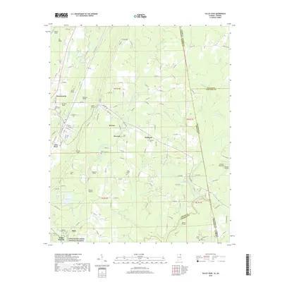
2018 Map of Valley Head
USGS Topo · Published 2018About this map
Lookout Mountain dominates this portion of the Alabama-Georgia border, where the high plateau gives way to the deep incisions of the West Fork Little River. Near the settlement of Mentone, the landscape is defined by its water features, including the dramatic De Soto Falls and the recreational waters of Moon Lake. The terrain transitions from the elevated ridges of Little Ridge and Big Ridge into the valley floors where Valley Head and Hammondville are situated along the historic corridor of Railroad Valley.
Find a feature on this map
152 named features on this map. Tap any name to fly to it.
Don’t see what you’re looking for? This feature index may not catch every label — zoom into the map to look around manually.
Map Details
Editions of this 2018 Valley Head Map
This is the sole edition of this map. No revisions or reprints were ever made.
Other maps of this area

1886 · Ringgold
USGS Topo · 1:125,000

1886 · Rome
USGS Topo · 1:125,000

1886 · Stevenson
USGS Topo · 1:125,000

1892 · Ringgold
USGS Topo · 1:125,000

1892 · Stevenson
USGS Topo · 1:125,000

1893 · Fort Payne
USGS Topo · 1:125,000

1895 · Stevenson
USGS Topo · 1:125,000

1898 · Rome
USGS Topo · 1:125,000

1898 · Fort Payne
USGS Topo · 1:125,000

1899 · Rome
USGS Topo · 1:125,000