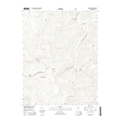
2014 Map of Valley Head
USGS Topo · Published 2014About this map
Valley Head serves as a central hub in this high-altitude landscape of Randolph County, where the Tygart Valley River begins its northward descent. The terrain is defined by parallel ridges such as Mill Ridge and Dry Ridge, punctuated by family-named landmarks that speak to the area's deep-rooted settlement history. Significant genealogical markers are scattered throughout the valleys, including Stalnaker Cem, Simmons Cem, and the Ware Cem located near Ware Ridge.
Find a feature on this map
54 named features on this map. Tap any name to fly to it.
Don’t see what you’re looking for? This feature index may not catch every label — zoom into the map to look around manually.
Map Details
Editions of this 2014 Valley Head Map
This is the sole edition of this map. No revisions or reprints were ever made.
Other maps of this area

1889 · Beverly
USGS Topo · 1:125,000

1891 · Huntersville
USGS Topo · 1:125,000

1892 · Beverly
USGS Topo · 1:125,000

1893 · Buckhannon
USGS Topo · 1:125,000

1894 · Huntersville
USGS Topo · 1:125,000

1896 · Buckhannon
USGS Topo · 1:125,000

1897 · Buckhannon
USGS Topo · 1:125,000

1901 · Monterey
USGS Topo · 1:125,000

1913 · Pickens
USGS Topo · 1:48,000

1915 · Pickens
USGS Topo · 1:62,500