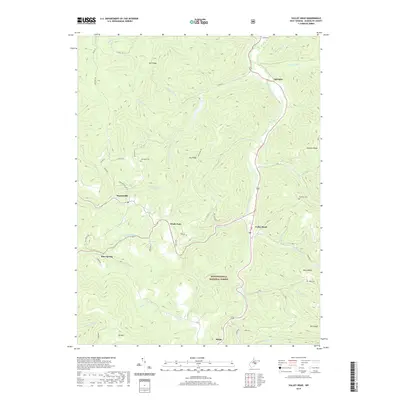
2019 Map of Valley Head
USGS Topo · Published 2019About this map
The Tygart Valley River carves a central path through this section of the Monongahela National Forest, defining the settlement patterns of several small mountain communities. Along the river and its many tributaries like Elkwater Fork and Ralston Run, clusters of homes and family landmarks are concentrated near the valley floor. To the west, Monterville and Brady Gate sit near the headwaters of Valley Fork, while the village of Mingo marks the southern reach of the survey. The terrain is structured by a series of prominent ridges including Mill Ridge, Dry Ridge, and Swecker Ridge, which separate the various drainage basins. For those researching local lineages, the map identifies family-named burial sites such as Stalnaker Cem, Simmons Cem, and Ware Cem, providing specific locations for these rural cemeteries. Prominent natural springs, including Blue Spring and Ezra Bennett Spring, further highlight the hydrological importance of this high-elevation landscape.
Find a feature on this map
49 named features on this map. Tap any name to fly to it.
Don’t see what you’re looking for? This feature index may not catch every label — zoom into the map to look around manually.
Map Details
Editions of this 2019 Valley Head Map
This is the sole edition of this map. No revisions or reprints were ever made.
Other maps of this area

1889 · Beverly
USGS Topo · 1:125,000

1891 · Huntersville
USGS Topo · 1:125,000

1892 · Beverly
USGS Topo · 1:125,000

1893 · Buckhannon
USGS Topo · 1:125,000

1894 · Huntersville
USGS Topo · 1:125,000

1896 · Buckhannon
USGS Topo · 1:125,000

1897 · Buckhannon
USGS Topo · 1:125,000

1901 · Monterey
USGS Topo · 1:125,000

1913 · Pickens
USGS Topo · 1:48,000

1915 · Pickens
USGS Topo · 1:62,500