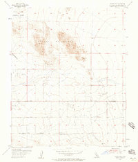
1954 Map of Valley Mtn
USGS Topo · Published 1958About this map
Valley Mountain dominates this mid-century desert landscape, providing a stark topographical anchor for a region increasingly shaped by military and transport infrastructure. The northern reaches are occupied by the Marine Corps Training Center, reflecting the strategic importance of the high desert for military preparedness during the early Cold War. Below the rugged slopes, the Ben Butler Mine and various prospects indicate a history of mineral exploration that persists alongside newer developments. The survey details a nascent network of desert corridors, including Valle Vista Road and the Twenty Nine Palms Highway, which facilitated the growth of nearby communities. Scattered water infrastructure like the Water Tank and several windmills reveal the essential struggle for resource management in this arid environment, while multiple landing fields and an Emergency Landing Field underscore the area's role in aviation and regional logistics.
Find a feature on this map
14 named features on this map. Tap any name to fly to it.
Don’t see what you’re looking for? This feature index may not catch every label — zoom into the map to look around manually.
Map Details
Editions of this 1954 Valley Mtn Map
3 editions found
Other maps of this area

1942 · Amboy
USGS Topo · 1:250,000

1943 · Amboy
USGS Topo · 1:250,000

1953 · San Bernardino
USGS Topo · 1:250,000

1954 · Needles
USGS Topo · 1:250,000

1954 · Valley Mtn
USGS Topo · 1:24,000

1955 · Deadman Lake SE
USGS Topo · 1:24,000

1955 · Lead Mountain SW
USGS Topo · 1:24,000

1955 · Twentynine Palms
USGS Topo · 1:24,000
1955 · Cleghorn Lakes
USGS Topo · 1:24,000

1955 · Twentynine Palms
USGS Topo · 1:62,500