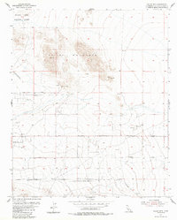
1954 Map of Valley Mtn
USGS Topo · Published 1986About this map
Valley Mountain dominates the northern reaches of this mid-century desert landscape, where the rugged peaks overlook a network of early roads and military infrastructure. In the early 1950s, the region was defined by its dual identity as a frontier for mining and a strategic training ground. The Marine Corps Training Center occupies the northwest corner, while several aviation markers including an Emergency Landing Field and a primary Landing Field emphasize the area's importance to desert flight operations. Local industry is represented by the Ben Butler Mine and scattered Prospects along the southern slopes of the range.
Find a feature on this map
13 named features on this map. Tap any name to fly to it.
Don’t see what you’re looking for? This feature index may not catch every label — zoom into the map to look around manually.
Map Details
Editions of this 1954 Valley Mtn Map
3 editions found
Other maps of this area

1942 · Amboy
USGS Topo · 1:250,000

1943 · Amboy
USGS Topo · 1:250,000

1953 · San Bernardino
USGS Topo · 1:250,000

1954 · Needles
USGS Topo · 1:250,000

1954 · Valley Mtn
USGS Topo · 1:24,000

1955 · Deadman Lake SE
USGS Topo · 1:24,000

1955 · Lead Mountain SW
USGS Topo · 1:24,000

1955 · Twentynine Palms
USGS Topo · 1:24,000
1955 · Cleghorn Lakes
USGS Topo · 1:24,000

1955 · Twentynine Palms
USGS Topo · 1:62,500