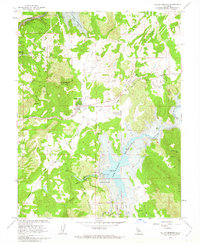
1962 Map of Valley Springs
USGS Topo · Published 1963About this map
Valley Springs serves as a focal point in this early 1960s topographic record, where the Southern Pacific railroad line intersects with local commerce and infrastructure. The landscape is undergoing significant hydrologic change, marked by the blue hatching of the New Hogan Reservoir and Camanche Reservoir, indicating areas subject to inundation following the completion of the New Hogan Dam. These massive water projects redefine the terrain around the Calaveras River and the Mokelumne River.
Find a feature on this map
36 named features on this map. Tap any name to fly to it.
Don’t see what you’re looking for? This feature index may not catch every label — zoom into the map to look around manually.
Map Details
Editions of this 1962 Valley Springs Map
3 editions found
Other maps of this area

1889 · Jackson
USGS Topo · 1:125,000

1892 · Jackson
USGS Topo · 1:125,000

1897 · Jackson
USGS Topo · 1:125,000

1902 · Jackson
USGS Topo · 1:125,000

1941 · Sutter Creek
USGS Topo · 1:62,500

1944 · Valley Springs
USGS Topo · 1:62,500

1944 · Sutter Creek
USGS Topo · 1:62,500

1945 · San Andreas
USGS Topo · 1:62,500

1947 · San Andreas
USGS Topo · 1:62,500

1947 · Sacramento
USGS Topo · 1:250,000