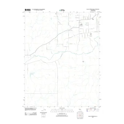
2012 Map of Valley Springs SW
USGS Topo · Published 2012About this map
Mother Lode Acres and the surrounding ranchlands of Calaveras County define this landscape, where residential development meets traditional California ranching. The Calaveras River winds through the center of the sheet, served by a network of rural roads such as Shelton Road and North Wimer Road. This era shows the expansion of named neighborhoods like Oak Grove and Opal Hill near the river's path, contrasting with large established tracts like Ospital Ranch and Stone Corral Ranch. Water management is central to the area's geography, with the drainage systems of Indian Creek, Duck Creek, and North Fork Duck Creek cutting through the terrain. The presence of features like South Gulch indicates the varied topography that has shaped settlement patterns from the valley floors to the rising hillsides.
Find a feature on this map
46 named features on this map. Tap any name to fly to it.
Don’t see what you’re looking for? This feature index may not catch every label — zoom into the map to look around manually.
Map Details
Editions of this 2012 Valley Springs SW Map
This is the sole edition of this map. No revisions or reprints were ever made.
Other maps of this area

1889 · Jackson
USGS Topo · 1:125,000

1892 · Jackson
USGS Topo · 1:125,000

1894 · Lodi
USGS Topo · 1:125,000

1897 · Jackson
USGS Topo · 1:125,000

1902 · Jackson
USGS Topo · 1:125,000

1908 · Linden
USGS Topo · 1:31,680

1909 · Clements
USGS Topo · 1:31,680

1915 · Trigo
USGS Topo · 1:31,680

1915 · Peters
USGS Topo · 1:31,680

1916 · Bachelor Valley
USGS Topo · 1:31,680