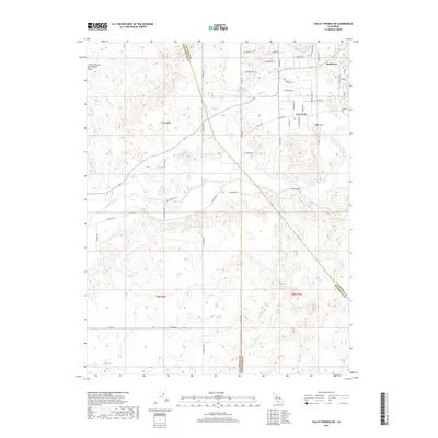
2018 Map of Valley Springs SW
USGS Topo · Published 2018About this map
The Calaveras River winds through this central California landscape where the Central Valley San Joaquin Valley meets the rising foothills. The residential character of Oak Grove stands out in the northeast corner, defined by a network of local roads such as Jenny Lind RD and Scenic Valley RD. This 2018 survey captures a complex jurisdictional meeting point where the boundaries of San Joaquin, Calaveras, and Stanislaus counties converge near the watercourses of Duck Cr and N Fork Duck Cr. The topography shifts from the flat river valley toward features like Opal Hill and South Gulch, illustrating the transition from agriculture and open land to more structured rural development.
Find a feature on this map
52 named features on this map. Tap any name to fly to it.
Don’t see what you’re looking for? This feature index may not catch every label — zoom into the map to look around manually.
Map Details
Editions of this 2018 Valley Springs SW Map
This is the sole edition of this map. No revisions or reprints were ever made.
Other maps of this area

1889 · Jackson
USGS Topo · 1:125,000

1892 · Jackson
USGS Topo · 1:125,000

1894 · Lodi
USGS Topo · 1:125,000

1897 · Jackson
USGS Topo · 1:125,000

1902 · Jackson
USGS Topo · 1:125,000

1908 · Linden
USGS Topo · 1:31,680

1909 · Clements
USGS Topo · 1:31,680

1915 · Trigo
USGS Topo · 1:31,680

1915 · Peters
USGS Topo · 1:31,680

1916 · Bachelor Valley
USGS Topo · 1:31,680