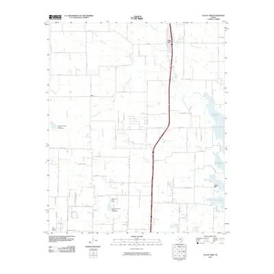
2010 Map of Valley View
USGS Topo · Published 2010About this map
Valley View serves as the primary northern hub in this Texas landscape, where the transit corridor of S Interstate Highway 35 Frontage Rd bisects a region defined by agricultural history and modern water management. The eastern edge is dominated by the sprawling reaches of Ray Roberts Lake, while the interior countryside is dotted with long-established settlements like Lois and Union Hill.
Find a feature on this map
66 named features on this map. Tap any name to fly to it.
Don’t see what you’re looking for? This feature index may not catch every label — zoom into the map to look around manually.
Map Details
Editions of this 2010 Valley View Map
This is the sole edition of this map. No revisions or reprints were ever made.
Other maps of this area

1902 · Gainesville
USGS Topo · 1:125,000

1943 · Gainesville
USGS Topo · 1:125,000

1954 · Sherman
USGS Topo · 1:250,000

1958 · Sherman
USGS Topo · 1:250,000

1960 · Sanger
USGS Topo · 1:24,000

1960 · Green Valley
USGS Topo · 1:24,000

1960 · Gainesville South
USGS Topo · 1:24,000

1960 · Woodbine
USGS Topo · 1:24,000

1961 · Era
USGS Topo · 1:24,000
1961 · Era SE
USGS Topo · 1:24,000