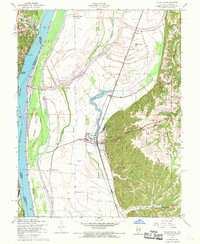
1954 Map of Valmeyer
USGS Topo · Published 1969About this map
Valmeyer and the surrounding river bottomlands of Monroe Co are defined by a complex system of water management and transport just after the mid-century. A substantial Levee system protects the agricultural plains from the Mississippi River, which separates Illinois from Missouri. The Missouri Pacific railroad serves as the primary industrial artery, passing near the Oil Tanks and through the heart of the village.
Find a feature on this map
33 named features on this map. Tap any name to fly to it.
Don’t see what you’re looking for? This feature index may not catch every label — zoom into the map to look around manually.
Map Details
Editions of this 1954 Valmeyer Map
4 editions found
Other maps of this area

1910 · Waterloo
USGS Topo · 1:62,500

1912 · Kimmswick
USGS Topo · 1:62,500

1913 · Waterloo
USGS Topo · 1:62,500

1915 · Renault
USGS Topo · 1:62,500

1915 · Crystal City
USGS Topo · 1:62,500

1916 · Kimmswick
USGS Topo · 1:62,500

1940 · Renault
USGS Topo · 1:62,500

1948 · Kimmswick
USGS Topo · 1:62,500

1949 · Saint Louis
USGS Topo · 1:250,000

1949 · Crystal City
USGS Topo · 1:62,500