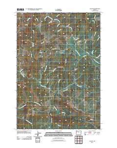
2011 Map of Valsetz
USGS Topo · Published 2011About this map
South Fork Siletz River and its numerous tributaries define this corner of the Oregon Coast Range, carved by a dense network of drainages including Whiskey Creek, Drift Creek, and Fanno Creek. The terrain is characterized by prominent high points such as Chandler Mountain, Fanno Peak, and the distinctive Big Saddle. The presence of Western Camp and Camp Russell suggests a landscape historically shaped by timber operations or seasonal forestry work, a common pattern in this part of Polk County. Notable topographical landmarks like Buckskin Flat and Valsetz Falls provide specific points of interest for those tracing the history of local land use. The map also reveals a complex of access roads, including Valsetz Rd and Rock Creek Rd, which navigate the steep elevations between the Siletz River headwaters and the drainage of North Fork Mill Creek.
Find a feature on this map
41 named features on this map. Tap any name to fly to it.
Don’t see what you’re looking for? This feature index may not catch every label — zoom into the map to look around manually.
Map Details
Editions of this 2011 Valsetz Map
This is the sole edition of this map. No revisions or reprints were ever made.
Other maps of this area

1939 · Marys Peak
USGS Topo · 1:62,500

1942 · Euchre Mtn
USGS Topo · 1:62,500

1942 · Marys Peak
USGS Topo · 1:62,500

1942 · Valsetz
USGS Topo · 1:62,500

1942 · Toledo
USGS Topo · 1:62,500

1943 · Euchre Mtn
USGS Topo · 1:62,500

1953 · Salem
USGS Topo · 1:250,000

1954 · Salem
USGS Topo · 1:250,000

1956 · Valsetz
USGS Topo · 1:62,500

1957 · Marys Peak
USGS Topo · 1:62,500