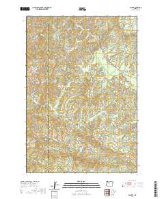
2020 Map of Valsetz
USGS Topo · Published 2020About this map
The Siletz River and its numerous tributaries dominate this high-elevation landscape along the border of Lincoln and Polk counties. This terrain is defined by dramatic peaks and ridges, including Diamond Peak, Green Mtn, and Fanno Peak, which stands as a prominent landmark on Fanno Ridge. The drainage network is particularly complex here, with the South Fork Siletz River and S Fork Siletz River carving through the mountains alongside smaller streams like Fourth of July Cr and Whiskey Cr.
Find a feature on this map
47 named features on this map. Tap any name to fly to it.
Don’t see what you’re looking for? This feature index may not catch every label — zoom into the map to look around manually.
Map Details
Editions of this 2020 Valsetz Map
This is the sole edition of this map. No revisions or reprints were ever made.
Other maps of this area

1939 · Marys Peak
USGS Topo · 1:62,500

1942 · Euchre Mtn
USGS Topo · 1:62,500

1942 · Marys Peak
USGS Topo · 1:62,500

1942 · Valsetz
USGS Topo · 1:62,500

1942 · Toledo
USGS Topo · 1:62,500

1943 · Euchre Mtn
USGS Topo · 1:62,500

1953 · Salem
USGS Topo · 1:250,000

1954 · Salem
USGS Topo · 1:250,000

1956 · Valsetz
USGS Topo · 1:62,500

1957 · Marys Peak
USGS Topo · 1:62,500