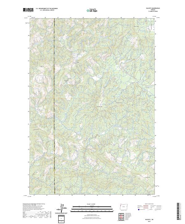
2023 Map of Valsetz
USGS Topo · Published 2023About this map
The Siletz River and its numerous tributaries dominate this drainage-rich section of the Oregon Coast Range, where the Lincoln Co / Polk Co line divides a landscape of high ridges and deep creek beds. Notable summits like Diamond Peak and Chandler Mtn define the verticality of the terrain, while landmarks such as Big Saddle and Buckskin Flat provide orientation in the dense network of canyons. The map tracks the headwaters of several critical systems, including the North Fork Mill Creek and South Fork Siletz River. Unlike more developed regions, the road network here is primarily comprised of logging and access routes like Rock Creek Rd and Valsetz Rd, which navigate the steep gaps at Chandler Pass and along Fanno Ridge.
Find a feature on this map
44 named features on this map. Tap any name to fly to it.
Don’t see what you’re looking for? This feature index may not catch every label — zoom into the map to look around manually.
Map Details
Editions of this 2023 Valsetz Map
This is the sole edition of this map. No revisions or reprints were ever made.
Other maps of this area

1939 · Marys Peak
USGS Topo · 1:62,500

1942 · Euchre Mtn
USGS Topo · 1:62,500

1942 · Marys Peak
USGS Topo · 1:62,500

1942 · Valsetz
USGS Topo · 1:62,500

1942 · Toledo
USGS Topo · 1:62,500

1943 · Euchre Mtn
USGS Topo · 1:62,500

1953 · Salem
USGS Topo · 1:250,000

1954 · Salem
USGS Topo · 1:250,000

1956 · Valsetz
USGS Topo · 1:62,500

1957 · Marys Peak
USGS Topo · 1:62,500