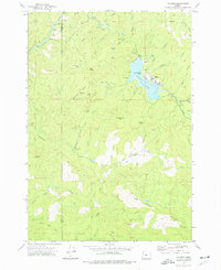
1974 Map of Valsetz
USGS Topo · Published 1977About this map
Valsetz sits at the heart of this mid-1970s survey, a company-owned timber town located along the shores of Valsetz Lake. The landscape is defined by the commercial forestry operations of the era, evidenced by the numerous Borrow Pits and a Quarry scattered among the peaks of Fanno Pk and Chandler Mtn. The transition from active habitation to archival history is visible in the identification of Western Camp (Site) and Camp Russell (Site), indicating the transient nature of mountain logging camps as operations shifted.
Find a feature on this map
41 named features on this map. Tap any name to fly to it.
Don’t see what you’re looking for? This feature index may not catch every label — zoom into the map to look around manually.
Map Details
Editions of this 1974 Valsetz Map
This is the sole edition of this map. No revisions or reprints were ever made.
Other maps of this area

1939 · Marys Peak
USGS Topo · 1:62,500

1942 · Euchre Mtn
USGS Topo · 1:62,500

1942 · Marys Peak
USGS Topo · 1:62,500

1942 · Valsetz
USGS Topo · 1:62,500

1942 · Toledo
USGS Topo · 1:62,500

1943 · Euchre Mtn
USGS Topo · 1:62,500

1953 · Salem
USGS Topo · 1:250,000

1954 · Salem
USGS Topo · 1:250,000

1956 · Valsetz
USGS Topo · 1:62,500

1957 · Marys Peak
USGS Topo · 1:62,500