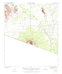
1941 Map of Vamori
USGS Topo · Published 1971About this map
Papago Indian Reservation lands dominate this 1940s survey of the Sonoran desert landscape, where water security dictates the pattern of human settlement. Small communities and clusters of structures are scattered across the Vamori Valley and the eastern edge of the Alvarez Mountains, including Vamori, Komelik, and Choulic. The reliance on local water sources is evident through the numerous Tanks and wells that support these desert outposts. To the south, the terrain rises toward Haivan Vaya near the international border, where the United States Mexico boundary line cuts across the desert floor. The map records several cemeteries and individual dwellings that reflect the localized Tohono O'odham history of the region before mid-century modernization. This desert environment is further defined by the broad drainage of Vamori Wash and the wide Baboquivari Valley to the east.
Find a feature on this map
20 named features on this map. Tap any name to fly to it.
Don’t see what you’re looking for? This feature index may not catch every label — zoom into the map to look around manually.
Map Details
Editions of this 1941 Vamori Map
3 editions found
Other maps of this area

1941 · Presumido Peak
USGS Topo · 1:62,500

1941 · Baboquivari Peak
USGS Topo · 1:62,500

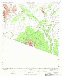
1941 · Vamori
USGS Topo · 1:62,500

1941 · Sells
USGS Topo · 1:62,500

1943 · Sells
USGS Topo · 1:62,500

1943 · Fresnal
USGS Topo · 1:125,000

1943 · Presumido Peak
USGS Topo · 1:62,500

1943 · Vamori
USGS Topo · 1:62,500

1944 · Baboquivari Peak
USGS Topo · 1:62,500

1954 · Sonoyta
USGS Topo · 1:250,000
Featured Places
- Topawa, AZ
- Chukut Kuk District, AZ
- Haivan Vaya, Chukut Kuk District
- San Agustin, Chukut Kuk District
- Choulic, Topawa