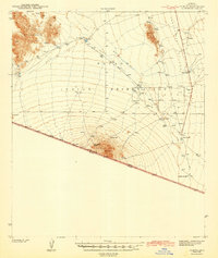
1943 Map of Vamori
USGS Topo · Published 1943About this map
Papago Indian Reservation dominates this desert landscape in southern Arizona, surveyed shortly before the United States entered World War II. The map details a series of traditional O'odham settlements and ranching outposts, including Vamori, San Miguel, and Komalik, which are connected by a network of unimproved roads and trails. The terrain is defined by the broad Vamori Valley and Baboquivari Valley, flanked by the Alvarez Mountains and the prominent Morena Mtn to the south.
Find a feature on this map
21 named features on this map. Tap any name to fly to it.
Don’t see what you’re looking for? This feature index may not catch every label — zoom into the map to look around manually.
Map Details
Editions of this 1943 Vamori Map
2 editions found
Other maps of this area

1941 · Presumido Peak
USGS Topo · 1:62,500

1941 · Baboquivari Peak
USGS Topo · 1:62,500

1941 · Vamori
USGS Topo · 1:62,500

1941 · Sells
USGS Topo · 1:62,500

1943 · Sells
USGS Topo · 1:62,500

1943 · Fresnal
USGS Topo · 1:125,000

1943 · Presumido Peak
USGS Topo · 1:62,500

1943 · Vamori
USGS Topo · 1:62,500

1944 · Baboquivari Peak
USGS Topo · 1:62,500

1954 · Sonoyta
USGS Topo · 1:250,000
Featured Places
- Topawa, AZ
- Chukut Kuk District, AZ
- Haivan Vaya, Chukut Kuk District
- San Agustin, Chukut Kuk District
- Choulic, Topawa